


The Town of Stallings is situated on I-485, approximately 14 miles southeast of downtown Charlotte, NC, within one of the fastest-growing metro areas in the country. Anticipating significant growth, DbD spearheaded the development of detailed small-area master plans for six distinct nodes.
Small Area Plans
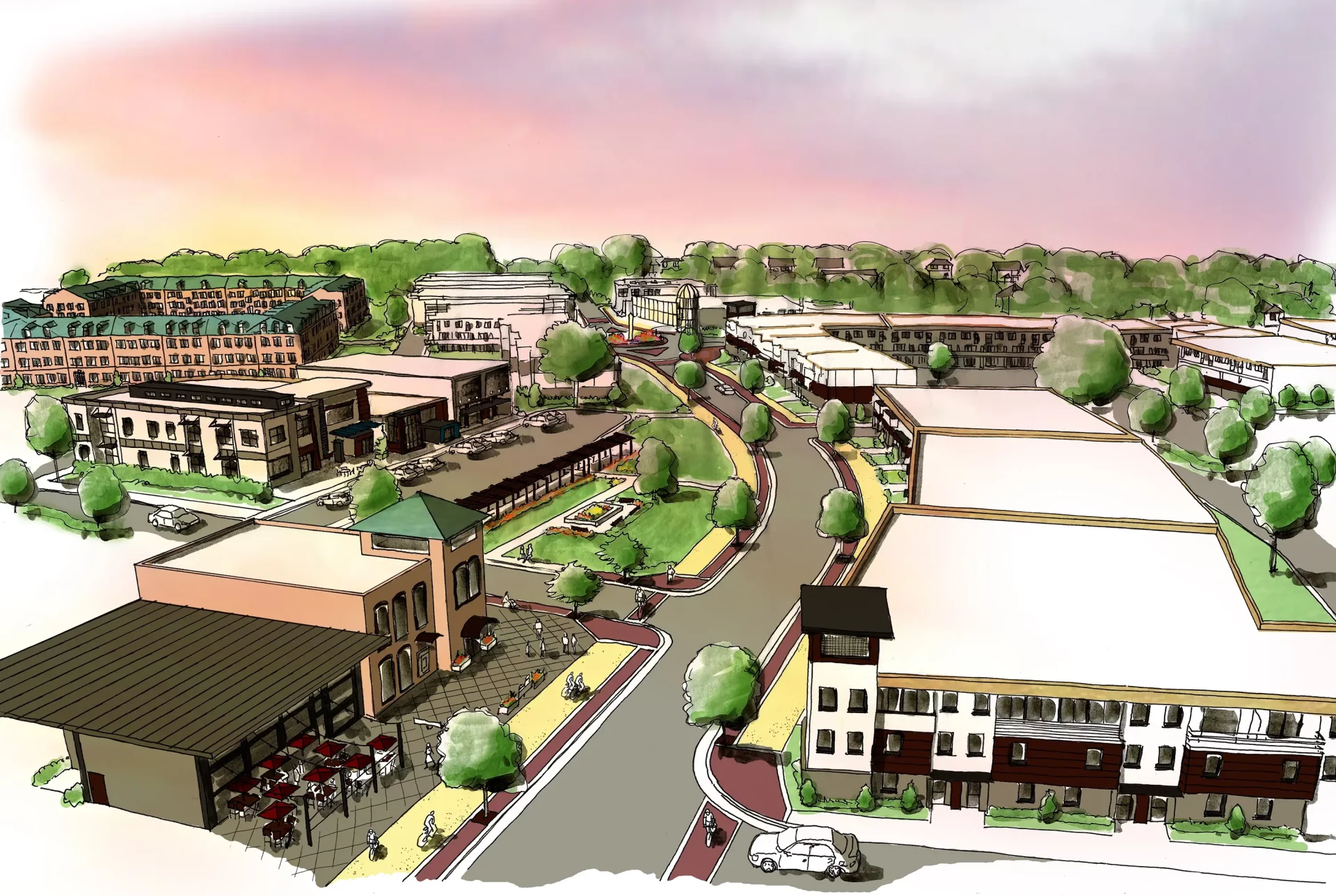
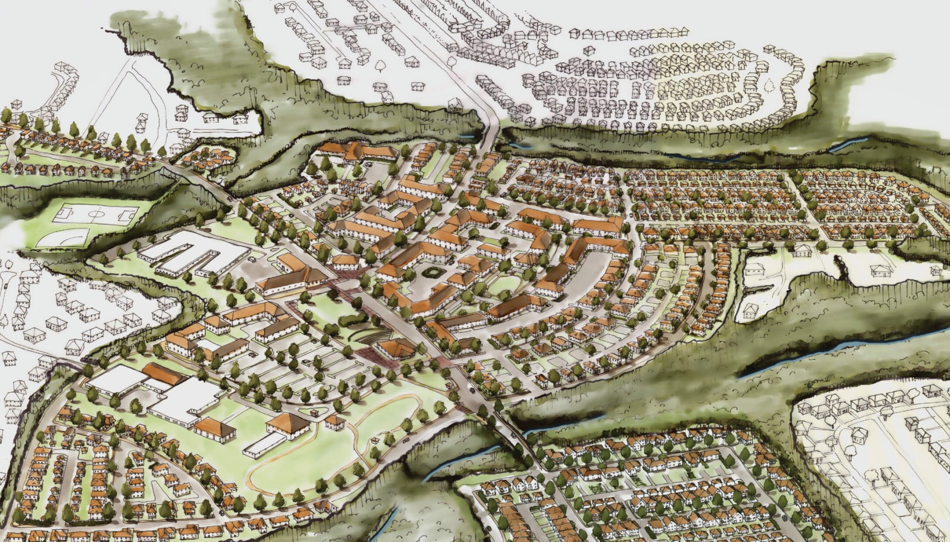
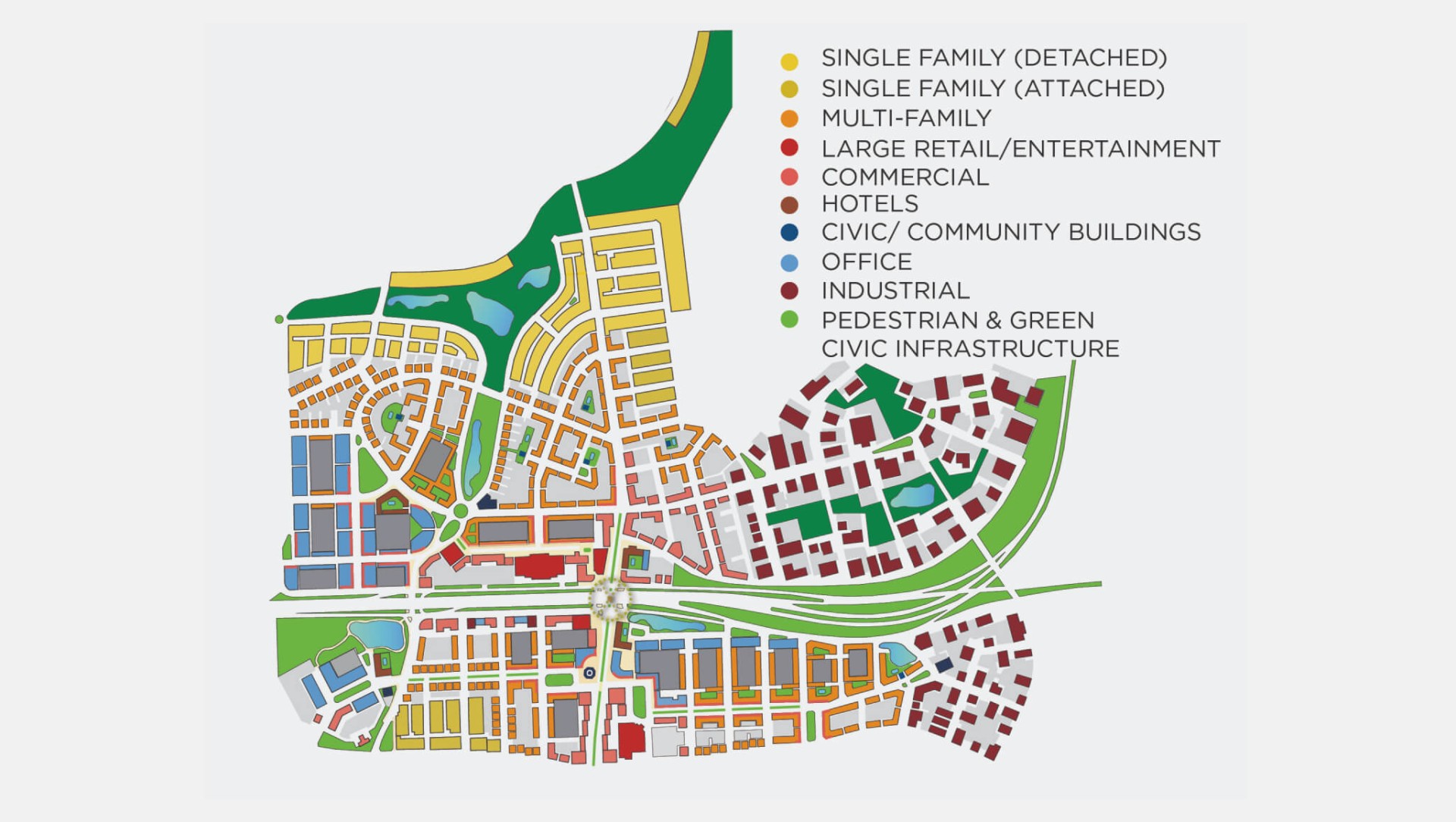
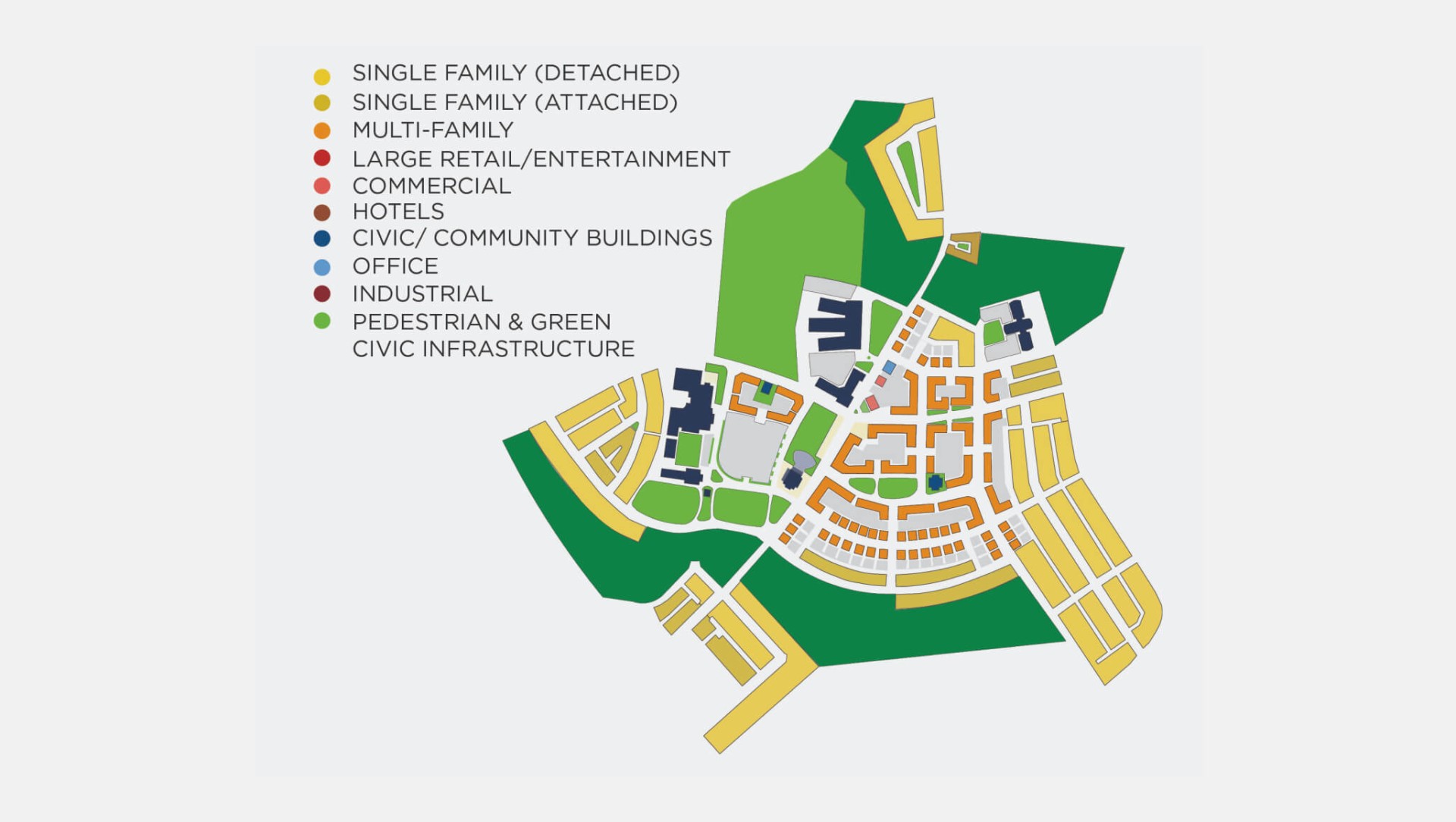
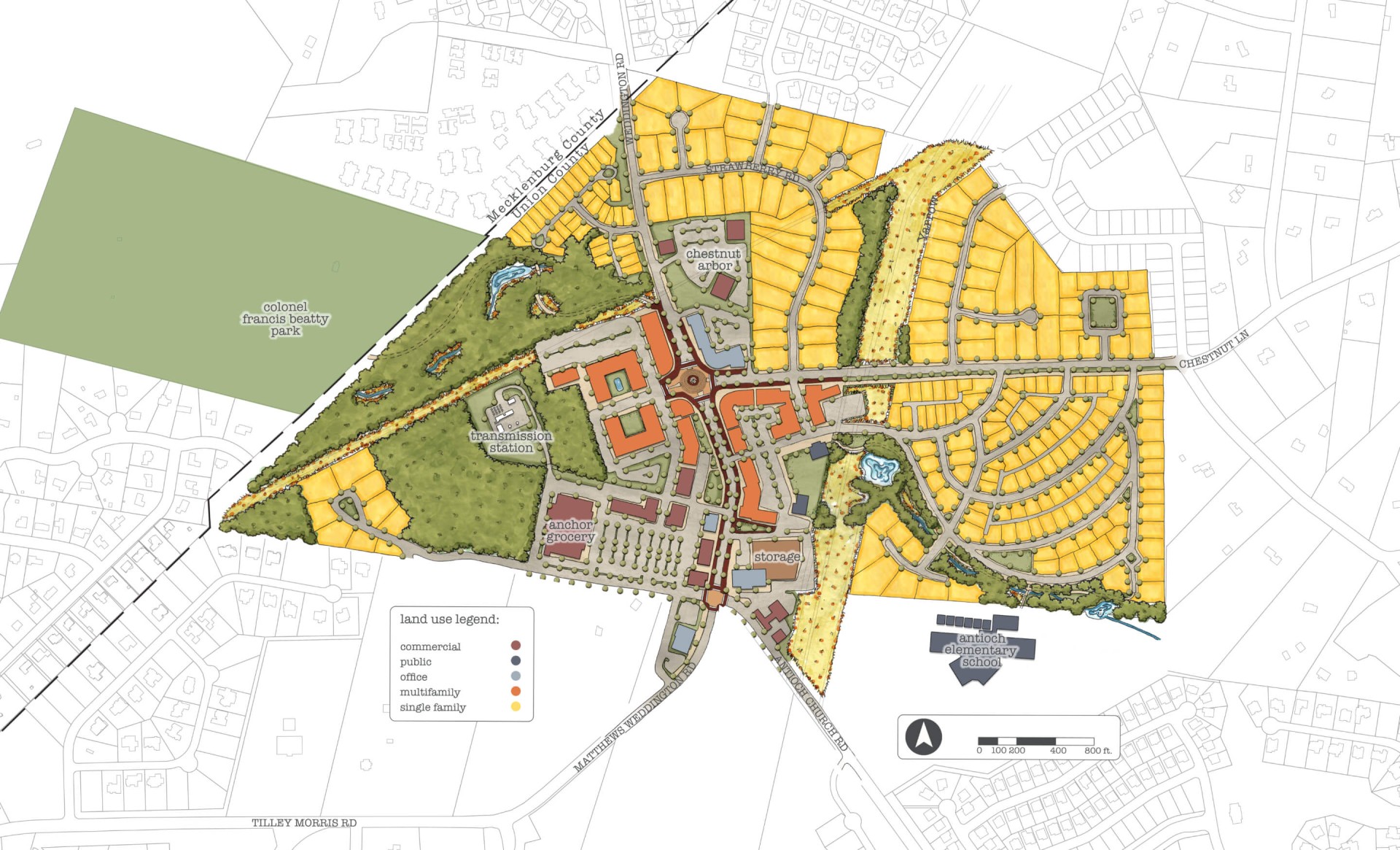
Each plan features a land use map and an illustrative site plan that envisions a pedestrian-oriented urban form, safeguarding existing neighborhoods while strategically incorporating multi-family housing and mixed-use densities to foster a sense of place and a robust tax base for future amenities.


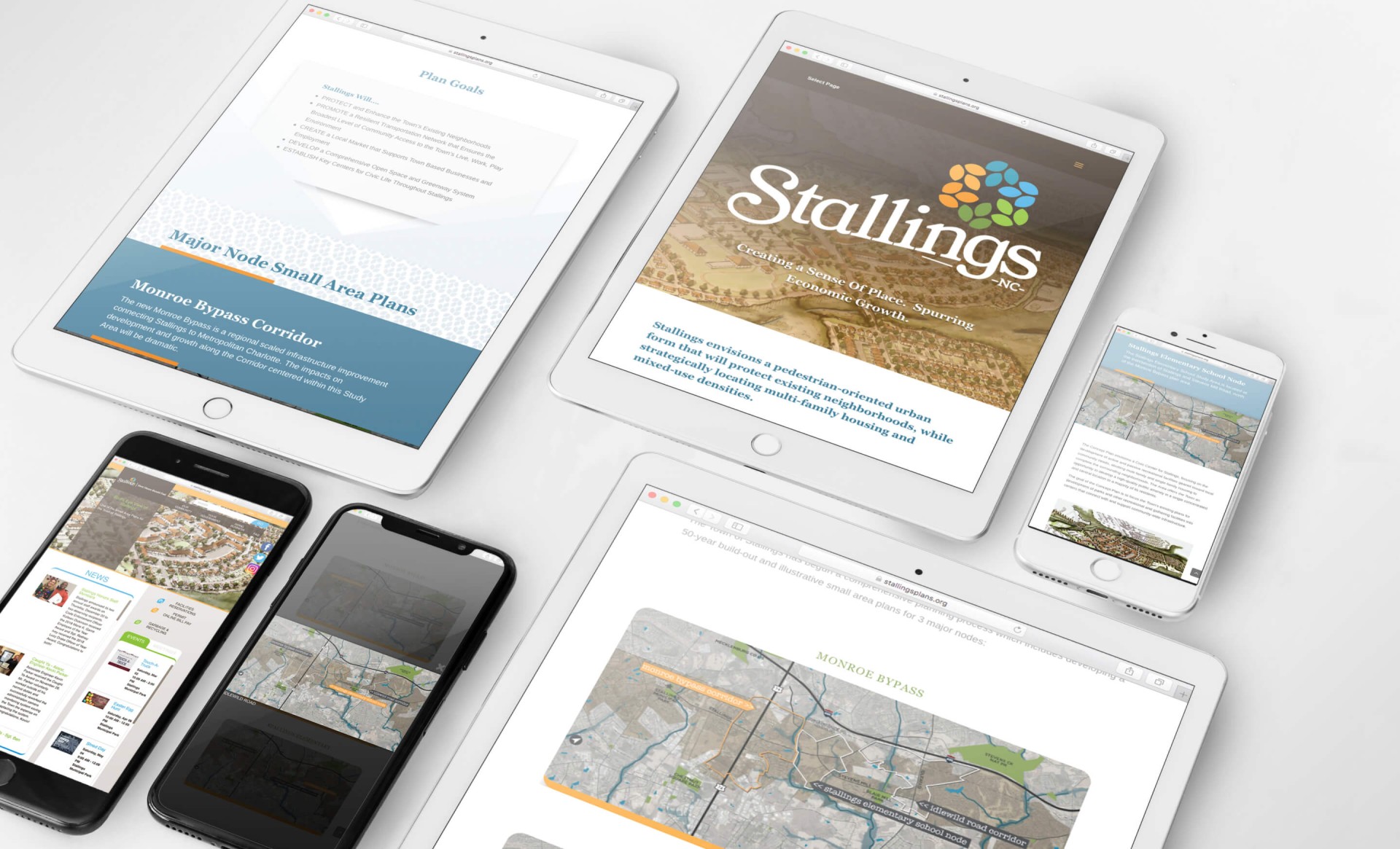
Website
At the conclusion of the plan, our Communications team developed a website for the Town detailing the plan for stakeholders and developers.
Destination by Design partnered with the Town of Stallings to develop small-area master plans for six distinct nodes throughout the town, emphasizing walkability, multi-family housing, and mixed-use densities to prepare for continued growth. Each plan includes a land use map and illustrative site plan designed to safeguard existing neighborhoods while strategically incorporating new density to build a stronger tax base for future community amenities.
In North Carolina, land use planning and greenway development work especially well together in fast-growing suburban towns that need to weave recreation infrastructure into new development from the start. Stallings’ civic master plan reflects that pairing, informing the town’s later Connect Stallings Greenway Master Plan and ensuring new pedestrian-oriented development nodes would integrate cleanly with the town’s expanding trail network.
Managing growth well means planning for density before it arrives, not reacting to it afterward. Stallings’ civic master plan does exactly that, using detailed small-area planning across six nodes to guide the Town’s development within one of the fastest-growing metro areas in the country, positioned just 14 miles southeast of downtown Charlotte along I-485.
Land use planning is the process of developing detailed land use maps and site plans that guide how a community grows, balancing new development with the character of existing neighborhoods. For Stallings, that meant civic master planning and small area planning across six distinct nodes, supported by public engagement and a dedicated website presenting the plan to stakeholders and developers.
Stallings sits along I-485 approximately 14 miles southeast of downtown Charlotte, placing it within one of the fastest-growing metro areas in the country. That proximity to Charlotte’s expanding suburbs made proactive small-area planning essential, giving the town a framework to manage growth across its six planning nodes before development outpaces its infrastructure.